Saturday, May 29, 2010

Protests turn deadly in Thailand

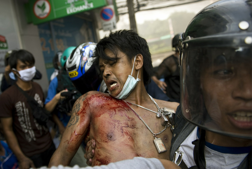
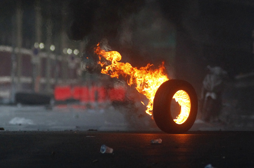
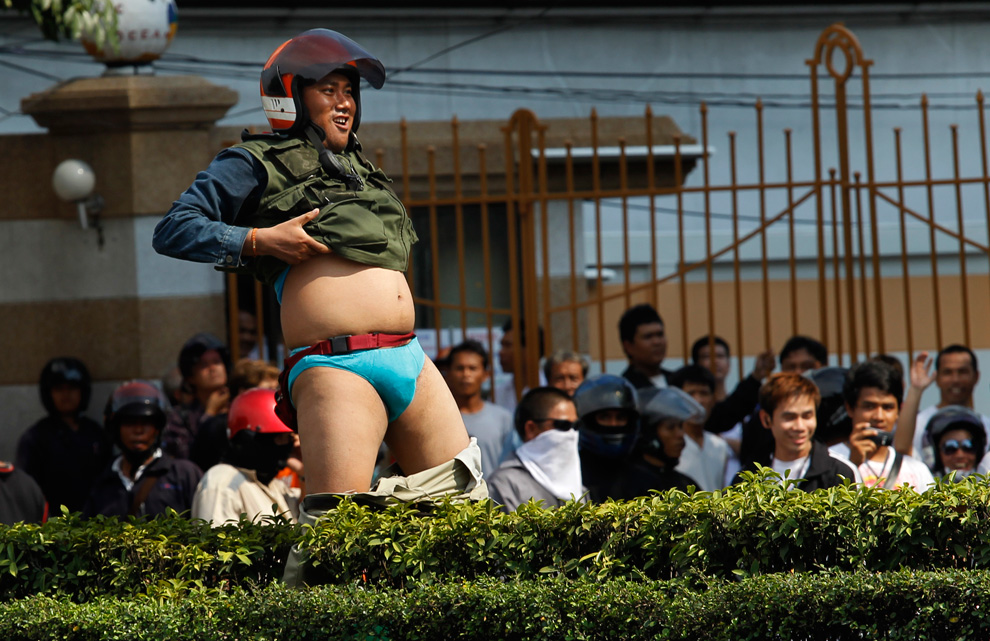
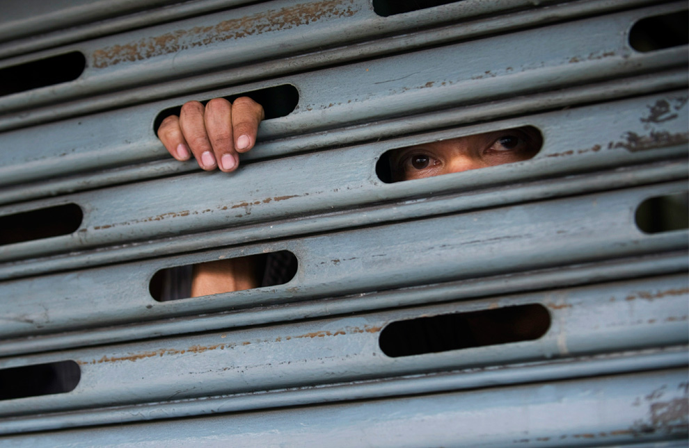
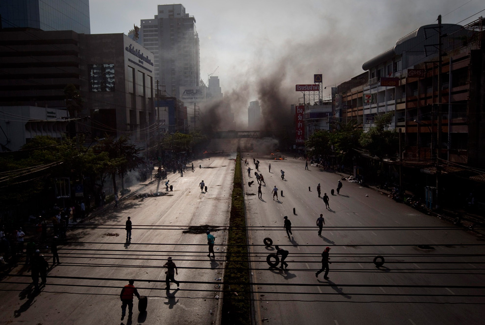
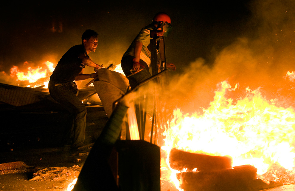
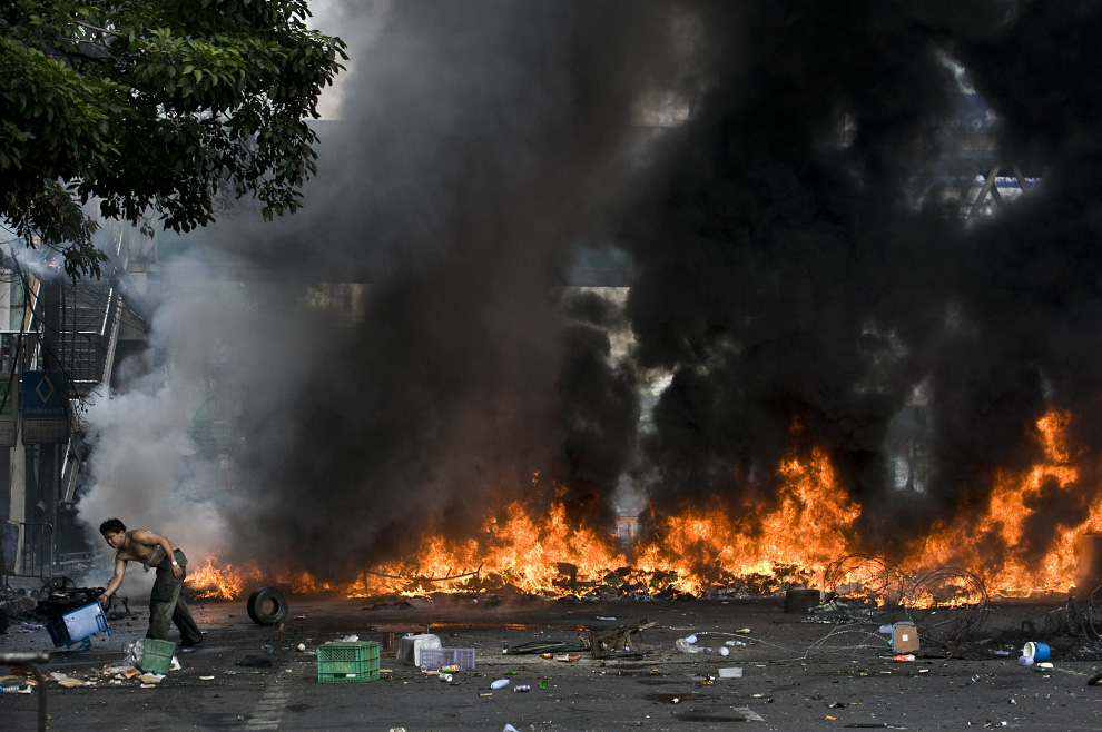
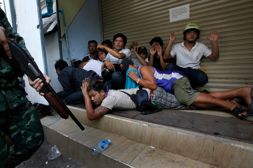
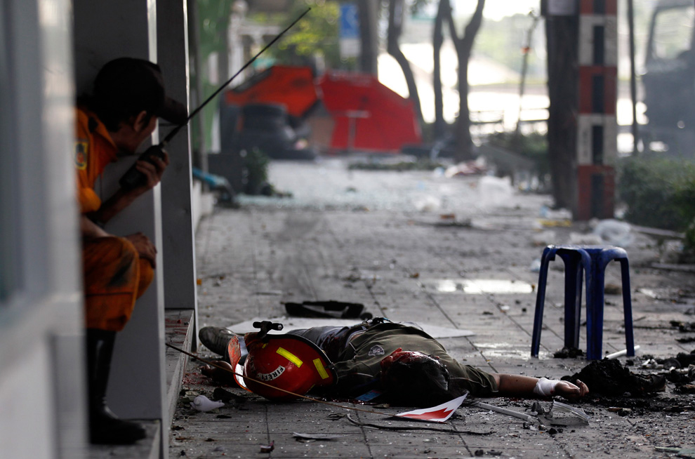
The Red Shirt political protest in Bangkok, Thailand has been active for nearly two months now, and has entered a new, deadly phase in the past week, with at least 36 of the total 60 deaths occurring in just the last few days. Anti-government protesters have barricaded themselves against government troops and the Thai army has declared certain protest areas to be "Live Fire Zones". A state of emergency is in effect, covering 17 provinces in the country, as protesters have refused orders to leave, and news just emerged that a renegade general who supported the Red Shirts, Khattiya Sawatdithol, died today from a gunshot wound he suffered on May 13th. Collected here are photos of the recent turmoil in central Bangkok. (39 photos total)

A "Red Shirt" anti-government protester kneels down as he runs away from gunfire as the violence in central Bangkok continues on May 16, 2010 in Bangkok, Thailand. (Athit Perawongmetha/Getty Images)

Thai soldiers stand off with a crowd of Red Shirt protesters, Friday, May 14, 2010 in Bangkok, Thailand. (AP Photo/Wally Santana) #

Red Shirt protesters fire home-made rockets toward Thai soldiers on Sunday May 16, 2010 in Bangkok, Thailand. (AP Photo/Sakchai Lalit) #

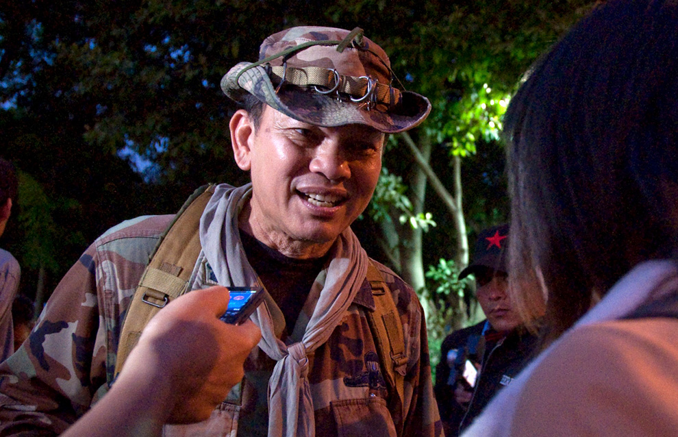
Renegade Thai major-general Khattiya Sawasdipol, only moments before being shot while being interviewed by Thai and foreign reporters in Bangkok on May 13, 2010. Khattiya, better known as Seh Daeng, a rogue soldier and de facto military chief of Thailand's red shirt protest movement later died from the wound. (REUTERS/Cyrille Andres) #

Renegade Thai major-general Khattiya Sawasdipol slumps on the ground moments after being shot in the head while being interviewed by Thai and foreign reporters in Bangkok on May 13, 2010. (REUTERS/Cyrille Andres) #

A Buddhist monk prays for peace on the anti-government red shirt protesters main rally stage on May 16, 2010 in Bangkok, Thailand. (Getty Images) #

A demonstrator uses a slingshot against security forces during clashes in Bangkok on May 15, 2010. (PEDRO UGARTE/AFP/Getty Images) #

A demonstrator, wounded during clashes with security forces, is carried to an ambulance in Bangkok on May 15, 2010. (PEDRO UGARTE/AFP/Getty Images) #

A burning tire rolls toward the line of Thai soldiers moving to disperse Red Shirt protesters on Friday, May 14, 2010 in Bangkok, Thailand. (AP Photo/Wason Wanichakorn) #

A Red Shirt demonstrator taunts Thai soldiers in downtown Bangkok, Thailand on Friday, May 14, 2010. (AP Photo/Vincent Yu) #

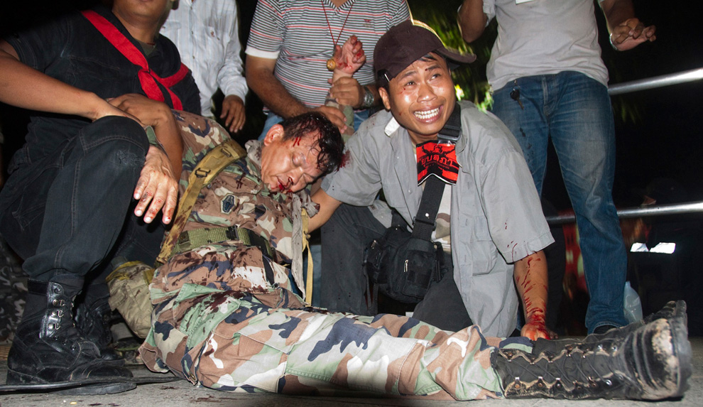
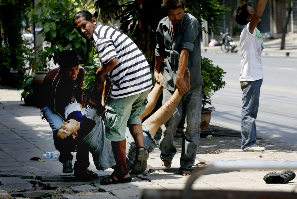
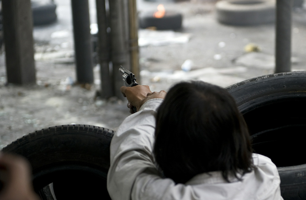
Red Shirt anti-government protesters crouch on the ground after several gunshots rang out and stuck two men, as hundreds of protesters gathered under the highway bridge on Rama 4, during clashes between demonstrators and security forces in Bangkok on May 16, 2010. (NICOLAS ASFOURI/AFP/Getty Images) #

A person peers out from behind the shutters of a shop during violent clashes between Red Shirt protesters and the military on May 14, 2010 in Bangkok. (Andy Nelson /Getty Images) #

Red Shirt protesters create a burning barricade on Rama IV road to stop army soldiers from advancing in Bangkok May 15, 2010. (REUTERS/Adrees Latif) #

Red Shirt protesters add to a burning barricade in the streets on May 14, 2010 in Bangkok, Thailand. (Andy Nelson /Getty Images) #

Red Shirt demonstrators watch Thai soldiers from behind their makeshift barricades on Friday, May 14, 2010, in Bangkok, Thailand. (AP Photo/David Longstreath) #

Thai soldiers in riot gear rest under a bridge outside the fortified camp of the Red Shirt movement in downtown Bangkok on May 13, 2010. (NICOLAS ASFOURI/AFP/Getty Images) #

An intoxicated Red Shirt supporter lies against a barricade made out of tires during clashes at Rama IV Street in Bangkok May 16, 2010. (REUTERS/Jerry Lampen) #

A Red Shirt supporter walks toward a barricade of tires which were set ablaze between army soldiers and protesters near Bangkok's Victory Monument May 16, 2010. (REUTERS/Adrees Latif) #

Thai Buddhist monks gather Sunday, May 16, 2010, at Victory Monument in Bangkok, Thailand to chant prayers for peace. (AP Photo/David Longstreath) #

A Thai man believed to be a Red Shirt demonstrator lies dead in the street after being shot by an unidentified sniper Saturday, May 15, 2010, in Bangkok, Thailand. (AP Photo) #

A broken window in a burned out shop is seen as a Red Shirt protester runs by as violence continues on May 16, 2010 in Bangkok, Thailand. (Paula Bronstein/Getty Images) #

Anti-government Red Shirt protesters carry the body of their dead comrade who was believed to have been shot by a sniper during clashes with Thai soldiers Saturday, May 15, 2010 in Bangkok, Thailand. (AP Photo/Wason Wanichakorn) #

A Red Shirt demonstrator fires a homemade firecracker toward Thai security forces as the violence in central Bangkok continues on May 16, 2010 in Bangkok, Thailand. (Athit Perawongmetha/Getty Images) #

A photographer takes a photograph as soldiers clash with anti-government Red Shirt protesters in Bangkok May 17, 2010. (REUTERS/Kerek Wongsa) #

A demonstrator shoots a pistol during clashes with security forces in Bangkok on May 15, 2010. (PEDRO UGARTE/AFP/Getty Images) #

A Thai man removes a can from a burning barricade in a main avenue of Bangkok during clashes between demonstrators and security forces on May 16, 2010. (PEDRO UGARTE/AFP/Getty Images) #

Anti-government demonstrators are arrested by Thai soldiers in downtown Bangkok, Thailand, Friday, May 14, 2010. (AP Photo/Vincent Yu) #

A Red Shirt protester who was wearing a fire-fighter's helmet lies on the sidewalk next to a flag with a red cross after being shot by army soldiers during clashes at Rama IV Street in Bangkok May 15, 2010. (REUTERS/Jerry Lampen) #

Red shirt protesters try to put out a fire as the violence in central part of the city escalates on May 15, 2010 in Bangkok, Thailand. (Paula Bronstein/Getty Images) #

Thai soldiers help each other to take position on a flyover during an operation to take control of an area around the fortified Red Shirt protesters' camp in Bangkok on May 14, 2010. (PEDRO UGARTE/AFP/Getty Images) #

Thai security forces fire toward Red Shirt protesters during a street clash on May 14, 2010 in Bangkok, Thailand. (Athit Perawongmetha/Getty Images) #

A Red Shirt supporter rallies with a Thai national flag from a "tuk tuk" after the Red Shirts secured parts of Rama IV from army troops with a burning barricade of tires in Bangkok May 15, 2010. (REUTERS/Adrees Latif) #

Pedestrians pause near posters on a Bangkok street to watch smoke rise from burning tires in Thailand on Monday, May 17, 2010. (AP Photo/Wally Santana) #

A soldier keeps watch near the perimeter of the barricaded anti-government Red Shirt encampment at Bangkok's shopping district May 15, 2010. (REUTERS/Caren Firouz) #

A man stands in front of a burning bus during clashes between Thai soldiers and anti-government protesters near Lumphini park in Bangkok's financial district May 14, 2010. (REUTERS/Damir Sagolj) #

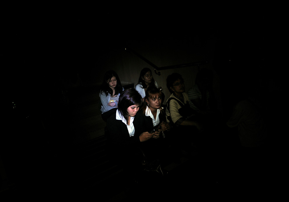
Guests and hotel staff sit in dark in the basement of the Dusit Thani hotel after they were evacuated following an explosion and gunfire being heard around the hotel early on May 17, 2010. An explosion nearby rattled the hotel room. Bullets hit the wall outside, then their telephones rang: "Come down you are under attack," the voice from reception warned. (MANAN VATSYAYANA/AFP/Getty Images) #

Red Shirt protesters set tires ablaze in front of a stand off with Thai military, Sunday, May 16, 2010 in Bangkok, Thailand. (AP Photo/Wally Santana) #

A Thai soldier runs to take cover during a clash with Red Shirt anti-government protesters in Bangkok on May 14, 2010. (NICOLAS ASFOURI/AFP/Getty Images) #

Dark smoke rises above Bangkok, Thailand as Red Shirt protesters burn tires at a main road downtown on Sunday, May 16, 2010. (AP Photo/Vincent Yu) #

Wednesday, May 19, 2010

Mount St. Helens, 30 years ago

On May 18th, 1980, thirty years ago today, at 8:32 a.m., the ground shook beneath Mount St. Helens in Washington state as a magnitude 5.1 earthquake struck, setting off one of the largest landslides in recorded history - the entire north slope of the volcano slid away. As the land moved, it exposed the superheated core of the volcano setting off gigantic explosions and eruptions of steam, ash and rock debris. The blast was heard hundreds of miles away, the pressure wave flattened entire forests, the heat melted glaciers and set off destructive mudflows, and 57 people lost their lives. The erupting ash column shot up 80,000 feet into the atmosphere for over 10 hours, depositing ash across Eastern Washington and 10 other states. Collected here are photos of the volcano and its fateful 1980 eruption. [Editor's note: I lived in Eastern Washington at the time, and have strong memories of this event, the dark skies, the strangeness of it all. I can't believe it's been 30 years. -Alan] (37 photos total)

Ash billows from the crater where the summit of Mount St. Helens had been only hours earlier during a huge eruption on May 18th, 1980. (USGS/Robert Krimmel)

Mount St. Helens on the day before the eruption, May 17, 1980, as viewed from what came to be known as Johnston Ridge, about six miles from the volcano. (AP Photo/USGS, Harry Glicken) #

USGS vulcanologist Dave Johnston collects samples from Mount St. Helens crater lake on April 30, 1980. Two months of earthquakes and minor eruptions brought many observers and scientists to the volcano for study. (USGS/R.P. Hoblitt) #

In this May 17, 1980 photo, 30-year old vulcanologist David Johnston is shown in the evening at his camp near what is now known as Johnston Ridge near Mount St. Helens. At 8:32 a.m. the next morning, Johnston radioed a message to the USGS headquarters: "Vancouver, Vancouver, this is it!", shortly before he was killed by the massive eruption of the volcano that also killed 56 others. (AP Photo/USGS Cascades Volcano Observatory, Harry Glicken) #

Mount St. Helens in eruption on May 18, 1980 showing the violence of the eruption in contrast with the apparently quiet countryside, Mount Adams in background, right. (USGS photo) #

Ash and steam billow from the crater of Mount St. Helens on May 18, 1980. (USGS photo) #

Thick hot mudflows begin to move downstream from the blast material deposited in the North Fork Toutle River valley downslope from erupting Mount St. Helens on May 18, 1980. This mudflow took nine hours to build in size sufficient to reach through the blasted material and move downstream to the Cowlitz River valley. The mudflow on the South Fork Toutle River arrived at Castle Rock, Washington, about 45 miles from the volcano, three hours after the eruption. (Harry Glicken) #

Bob Brown (right), John Brown and two other unidentified people are shown May 19, 1980 climbing onto a railroad car and heading down the train. The would-be horse rescuers gave up their efforts as they fled for their lives as flood waters from the Toutle River begin a sudden rise. All four people reached safety but the horses were presumed to have drowned. (AP Photo/Gary Stewart) #

Mount St. Helens in eruption. Aerial view of upper part of volcano and the eruptive column on MAy 18th, 1980. (USGS photo) #

Mount St. Helens sends a plume of ash, smoke and debris skyward in this May 18, 1980 photo. The ash plume is being carried eastward by prevailing winds, depositing ash across several states. (AP Photo/US Geological Survey) #

A satellite image shows the eastward spread of the ash plume across Washington state from the May 18th, 1980 eruption of Mount St. Helens, approximately one hour after the initial eruption. (NOAA) #

Ashen clouds from the Mount St. Helens volcano move over Ephrata airport in Washington on Monday, May 19, 1980. (AP Photo/Mike Cash) #

A car is shown submerged in ash in this May 20, 1980 photo from Mount St. Helens eruption in Washington State. (AP Photo) #

This aerial view shown May 23, 1980 from a search and rescue helicopter shows the new crater on Mount St. Helens formed by Sunday's massive eruption. Scientists described St. Helens' new horseshoe-shaped crater as about 5,000 feet deep and about 2 1/2 miles wide north to south on the north side of the mountain. (AP Photo/Gary Stewart) #

A splintered stump is all that remains of a tree that had grown on a now-desolate ridge near the North Fork Toutle River near Mount St. Helens. (USGS/S.W. Kieffer) #

Massive blowdown of trees in the Green River valley seen on June 2, 1980. The flattening of the forest resulted from the May 18 eruption of Mount St. Helens. (USGS/J. DeVine) #

For weeks volcanic ash covered the landscape around the volcano and for several hundred miles downwind to the east. In this photograph, a helicopter stirs up ash while trying to land in the devastated area on August 22nd, 1980. (USGS/Lyn Topinka) #

Army National Guard helicopter pilot Harold Kolb rescues two men and their sons from the devastated area around Mount St. Helens. One man's hands had been burned from his tent melting around him. (Washington National Guard) #

A pyroclastic flow rushes down the side of Mount St. Helens on August 7, 1980. (USGS photo) #

The melted Dashboard of pickup truck located on ridge top about 14 km north of Mount St. Helens demonstrates the powerful heat generated by the volcanic blast. Photo taken on June 18, 1980. (USGS photo) #

An aerial view of a bridge in the North Fork Toutle River valley that had been battered by logs and rocks, then partially buried in a massive mudflow. (USGS photo) #

A helicopter rests near measuring instruments on Harrys Ridge on September 30, 1980, five miles north of Mount St. Helens' crater. (USGS/Lyn Topinka) #

A camper containing two victims of the Mount St. Helens eruption sits amidst the gray landscape about 8 miles from the mountain. Marks in the volcanic ash in front of and behind the camper were left by a helicopter and a seacher who found the victims on Tuesday, May 20, 1980. (AP Photo) #

An aerial view of blowdown and Fawn Lake, inside the blast zone on October 28, 1980 (note Mount St. Helens in the background). Note also the USGS scientists in a small boat in the middle of the lake taking water samples. (USGS/Lyn Topinka) #

Blowdown wraps around a hillside, showing how the lateral blast of the eruption followed the countours of the landscape, seen on August 22, 1980 near the North Fork Toutle River. (USGS/Lyn Topinka) #

A mudflow deposit covers Washington State Highway 504 near the town of Toutle, northwest of Mount St. Helens, to a depth of 2m (6 ft). Geologist for scale. (USGS/R.L. Schuster) #

Nearly 135 miles (220 kilometers) of river channels surrounding the volcano were affected by the mudflows of May 18, 1980. A dirty line left behind on tree trunks shows the depth reached by the mud. A scientist (middle right) gives scale. This view is along the Muddy River, southeast of Mount St. Helens on October 23, 1980. (USGS/Lyn Topinka) #

A vehicle is seen wrapped around tree due to the force of the mudflow on the North Fork Toutle River on July 11, 1980, near Camp Baker, northwest of Mount St. Helens in Washington state. (USGS photo) #

A wrecked logging truck and crawler tractor are shown amidst ash and downed trees near Mount St. Helens on May 20, 1980, two days after an explosive eruption. (AP Photo) #

Thousands of trees in the North Fork Toutle River drainage area are shown blown down by the force of the May 18, 1980, eruption of Mount St. Helens, seen on Aug. 22, 1980. (AP Photo/USGS, Lyn Topinka) #

The streets of Yakima, Washington are dark at 3:00 PM after an eruption at Mount St. Helens on May 18, 1980. Light gray volcanic ash covered the streets and passersby wore masks to avoid breathing the ash. (AP Photo) #

In this 1980 photo, a worker at an auto dealership in Moscow, Idaho used a blower to remove ash from the eruption of Mount St. Helens in Washington state, more than 350 miles away, from a car. (AP Photo/Moscow-Pullman Daily News) #

On the slopes of Mount St. Helens, colorful ponds dot the debris avalanche, their chemical composition varying wildly and affecting the color of the water. Photo taken on August 8, 1981. (USGS/Lyn Topinka) #

Mount St. Helens spews smoke and ash skyward as the volcano erupts once more on October 17th, 1980. (AP Photo/Jack Smith) #

When Mount St. Helens erupted, the preceding gigantic landslide actually displaced all of the water in nearby Spirit Lake, which washed up hillsides, then splashed back down, dragging debris and fallen trees into its new lakebed. This March 29, 2007 photograph shows just a portion of the thousands of trees that remain floating in a giant raft on the surface of the lake to this day. (USGS/Cindy Werner) #

The distinctive bloom of a Fireweed, a hearty pioneer plant, is seen with Spirit Lake in the background on September 4, 1984. (USGS/Lyn Topinka) #

In this May 7, 2010 photo, a timed exposure brings out Mount St. Helens against a backdrop of stars and the risen moon at left, in Washington state. (AP Photo/Ted S. Warren) #